É um Centro que tem como objetivo incentivar a prática regular da Marcha e Corrida, associando a promoção da prática desportiva à saúde e bem-estar dos munícipes. Os utilizadores beneficiam de supervisão e prescrição de exercício físico, com apoio de um técnico especializado, na sugestão das melhores estratégias de treino, incluindo uma avaliação física inicial.
Inscrição gratuita, a realizar nos locais de apoio, de Ermesinde e Valongo: O utilizador terá de pagar um seguro anual de 10€ à Federação Portuguesa de Atletismo.
It is a Center that aims to encourage the regular practice of the March and Run, associating the promotion of sports to the health and well-being of the citizens. Users benefit from supervision and exercise prescription, with the support of a specialized technician, in suggesting the best training strategies, including an initial physical assessment.
Free registration, to be carried out at the support locations, in Ermesinde and Valongo: The user will have to pay an annual insurance of €10 to the Portuguese Athletics Federation.
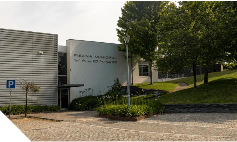
PISCINA MUNICIPAL DE VALONGO
Concentração - Segundas e Quartas ás 18:00H
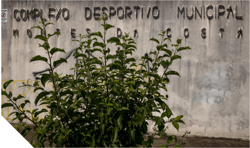
COMPLEXO DESPORTIVO MONTES DA COSTA
Concentração - Terças e Quintas ás 18:30H
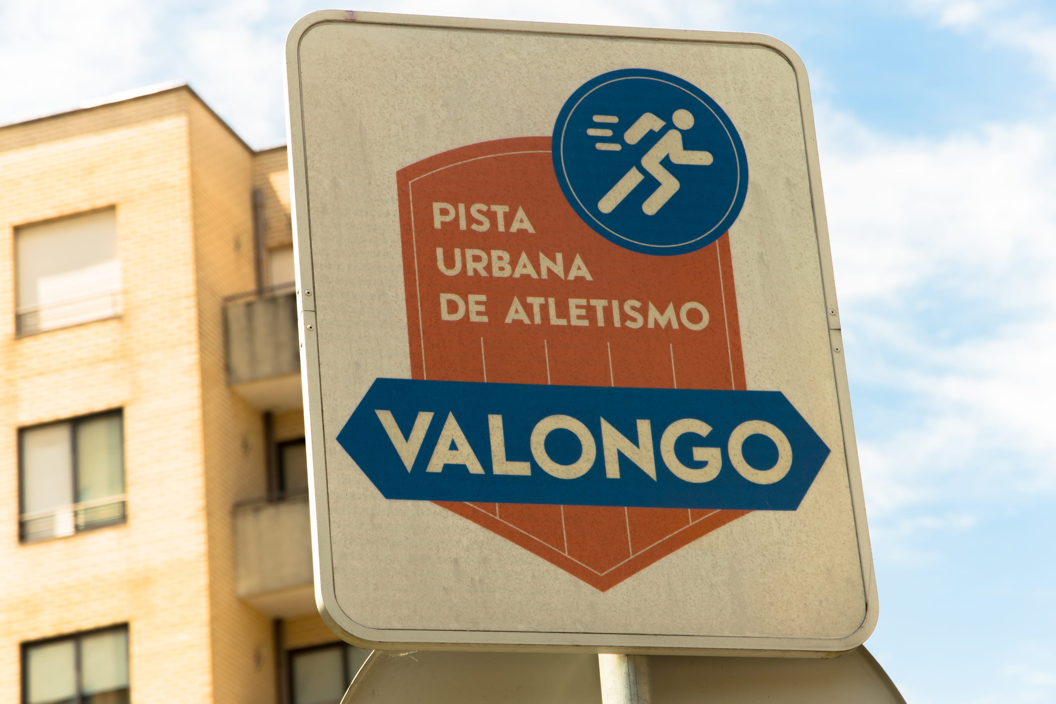
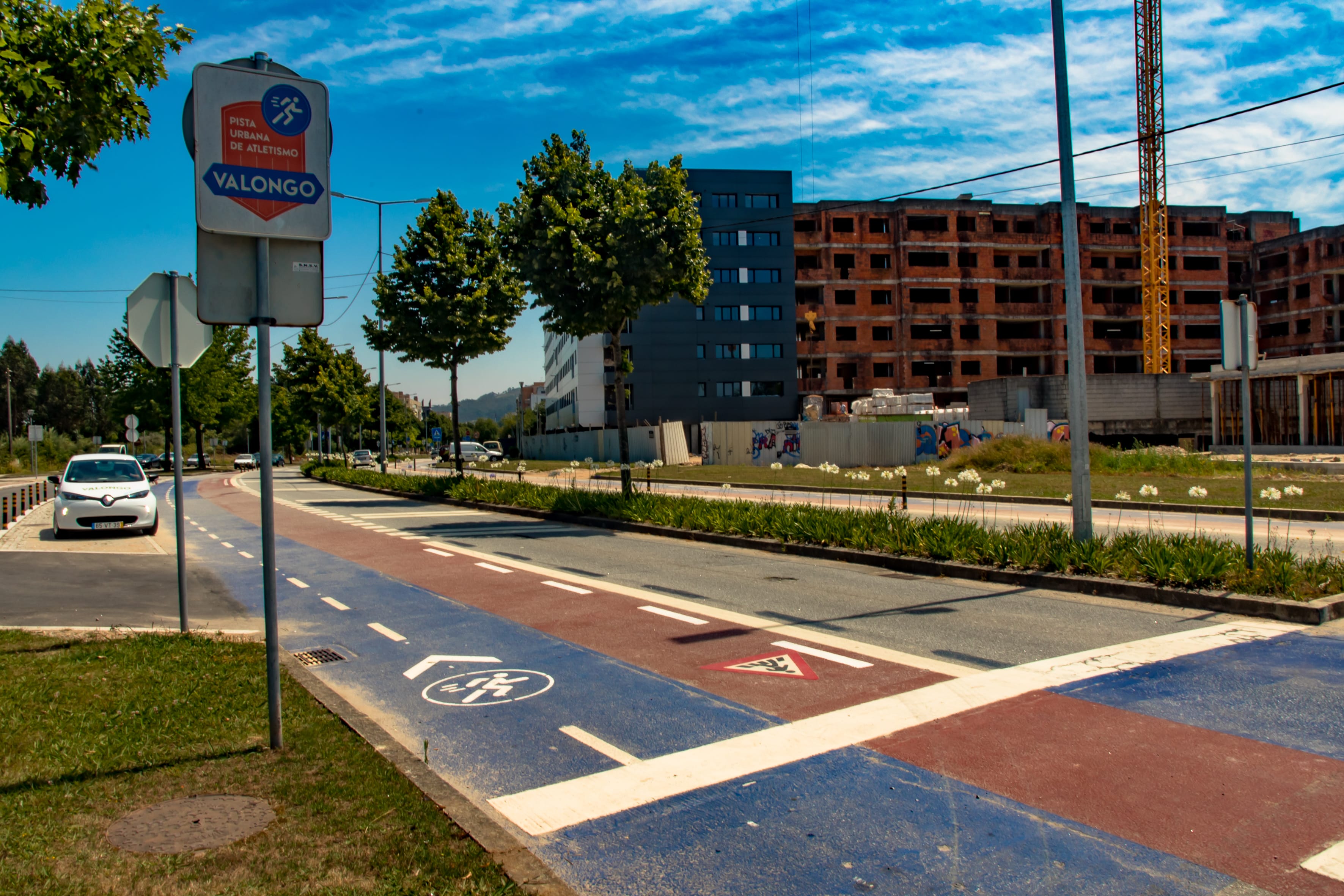
Muito próximo do centro da cidade de Valongo, concretamente na Avenida Dr. Fernando Melo, com 1600 metros de extensão, localiza-se a Pista Urbana de Atletismo, com um carater pioneiro, esta infraestrutura destinada à prática desportiva espontânea. Com baixo nível de dificuldade, tem condições para ser utilizada por aqueles que têm curiosidade ou desejam iniciar a corrida, mas também por atletas experientes.
Pretendeu-se disponibilizar à comunidade equipamentos que combatam o sedentarismo e incentivem um estilo de vida mais saudável com a inclusão da atividade física no seu quotidiano.
Very close to the city center of Valongo, specifically on Avenida Dr. Fernando Melo, 1600 meters long, is the Urban Athletics Track, with a pioneering character, this infrastructure intended for spontaneous sport. With a low level of difficulty, it can be used by those who are curious or want to start the race, but also by experienced athletes.
It was intended to provide the community with equipment to combat sedentary lifestyles and encourage a healthier lifestyle with the inclusion of physical activity in their daily lives
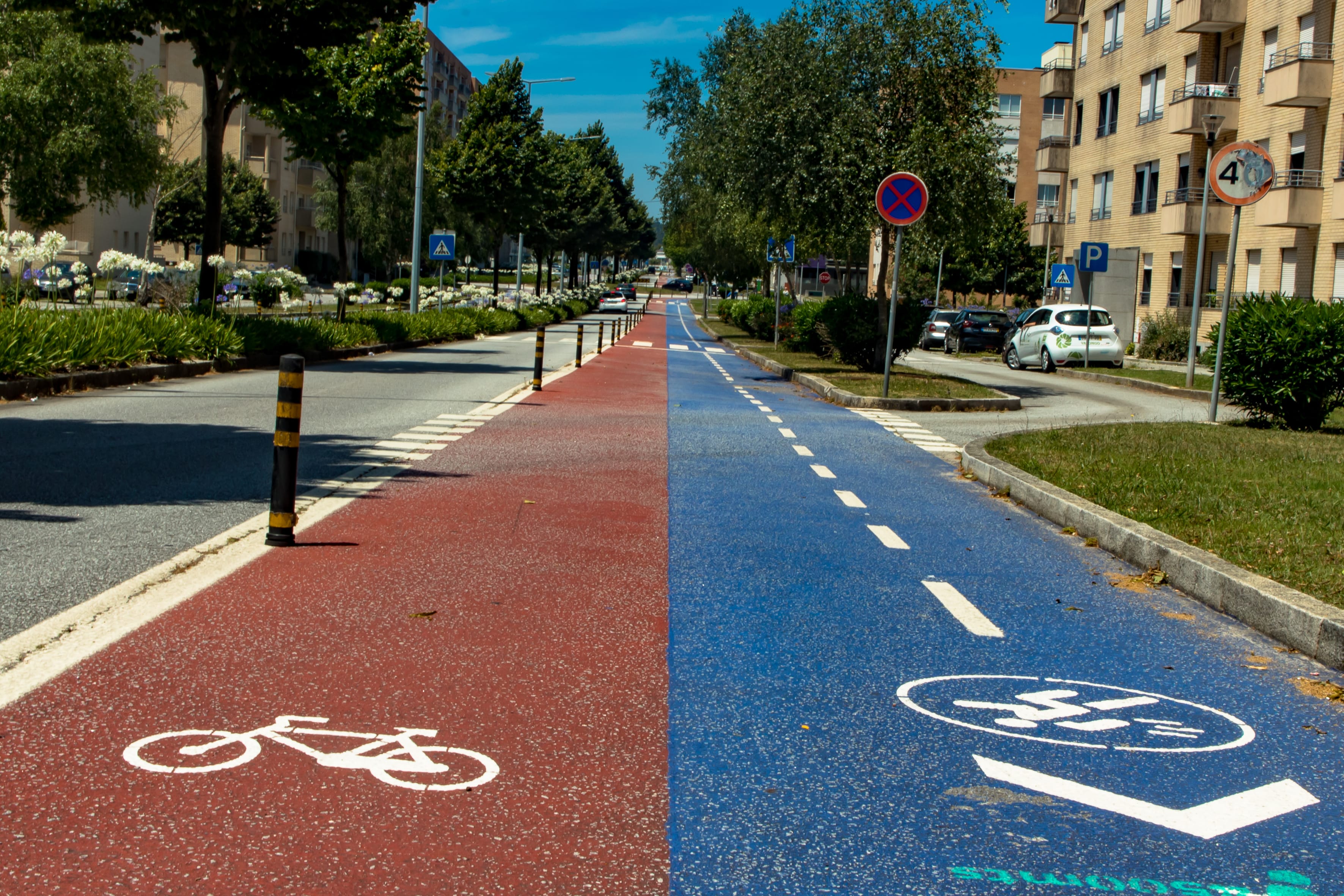
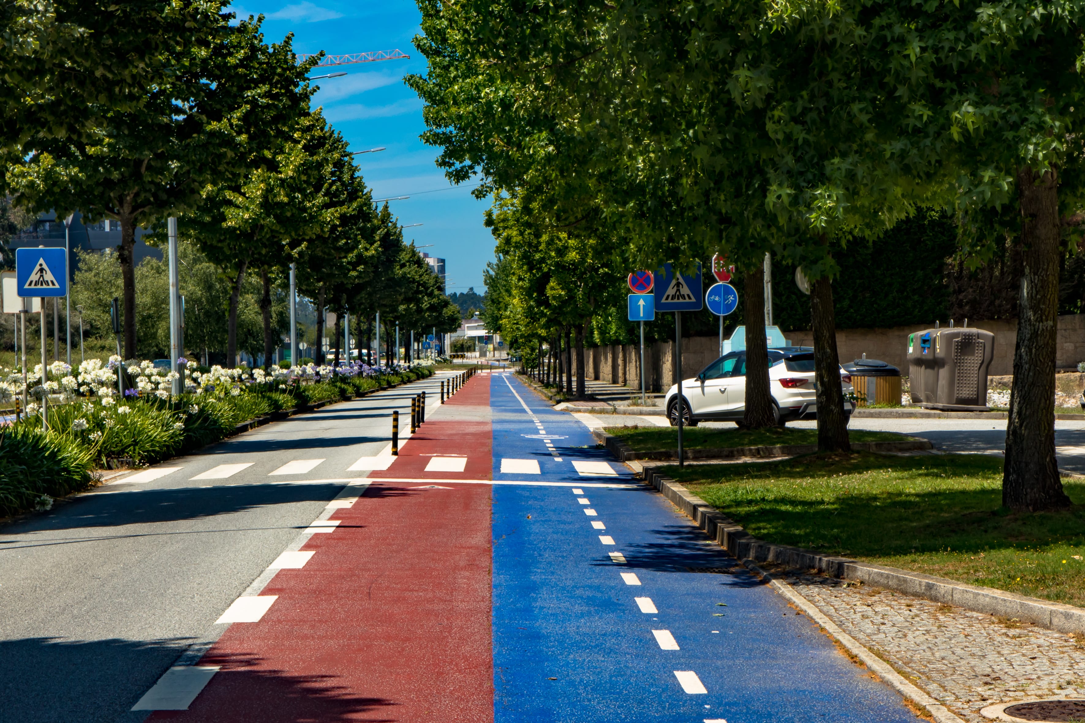
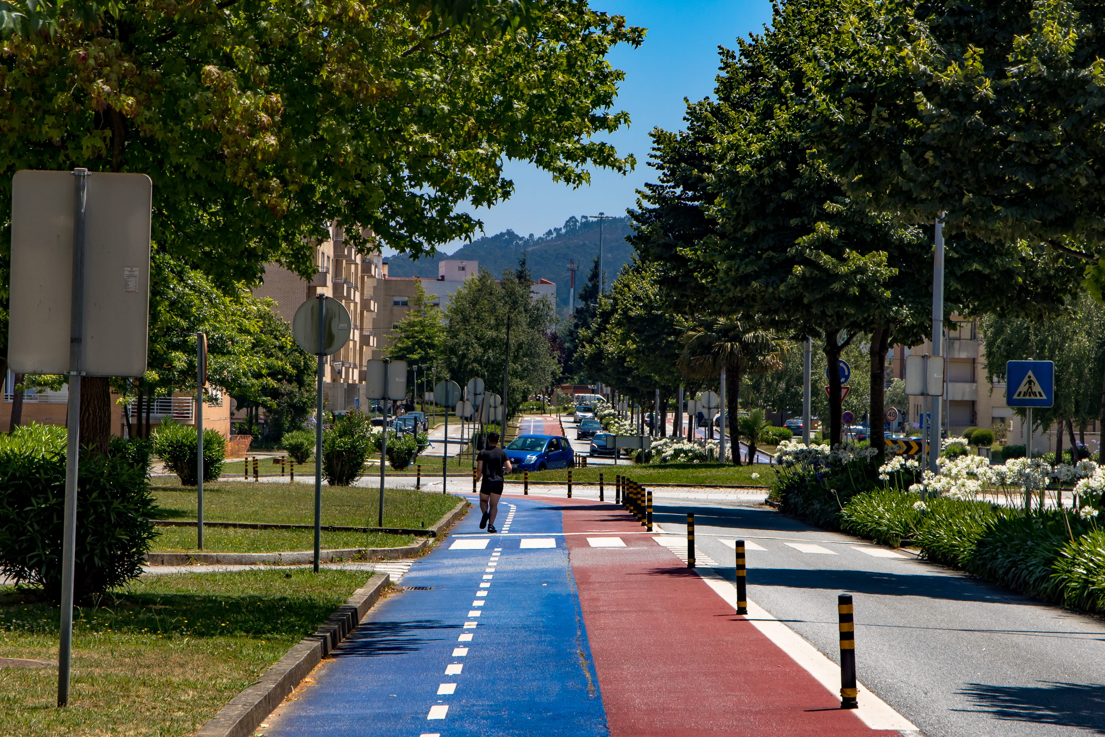
Uma das medidas mais importantes para a mobilidade sustentável e a transição para os modos suaves é a disponibilização de uma infraestrutura ciclável que, efetivamente sirva a população, em particular nos núcleos urbanos. É essencial criar condições de conforto e segurança para todos aqueles que queiram optar pelo uso da bicicleta.
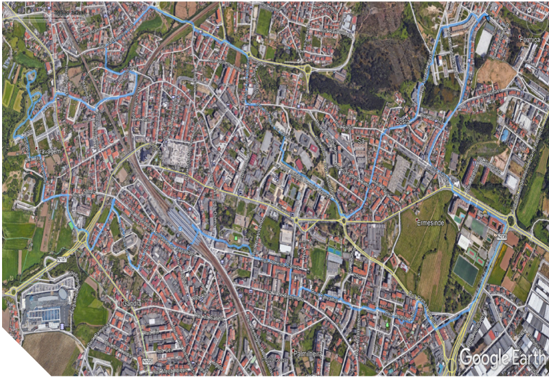
A par de Pista de Atletismo Urbano, encontra-se a Via Ciclável, que constitui a fase 1 do percurso ciclável de Valongo. Este troço com cerca de 2600 metros de extensão, faz a ligação entre esta importante zona residencial - Lagueirões e o Apeadeiro do Susão, permitindo a utilização da bicicleta, não só como forma de lazer, mas também como meio do transporte intermodal.
Com baixo nível de dificuldade este equipamento pode ser usufruído por utilizadores de qualquer faixa etária.
Esta infraestrutura, financiada pelo Programa Norte 2020, insere-se num projeto mais abrangente, o Plano de Mobilidade Urbana Sustentável de Valongo, com a duração de 10 anos.
Genericamente os objetivos do Plano de Mobilidade Urbana Sustentável de Valongo, são:
Nos próximos anos, pretende-se criar uma rede ciclável no concelho de Valongo, quer nos centros urbanos, quer de ligação entre freguesias, com possibilidade de conexão a outros concelhos.
One of the most important measures for sustainable mobility and the transition to soft modes is the provision of a cycling infrastructure that effectively serves the population, particularly in urban centers. It is essential to create conditions of comfort and safety for all those who want to use a bicycle.
Alongside the Urban Athletics Track, there is the Via Ciclável, which constitutes stage 1 of the Valongo cycle route. This stretch of about 2600 meters in length, connects this important residential area - Lagueirões and Apeadeiro do Susão, allowing the use of bicycles, not only as a form of leisure, but also as a means of intermodal transport.
With a low level of difficulty, this equipment can be used by users of any age group.
This infrastructure, financed by the Norte 2020 Programme, is part of a more comprehensive project, the Valongo Sustainable Urban Mobility Plan, with a duration of 10 years.
Generally speaking, the objectives of the Valongo Sustainable Urban Mobility Plan are:
In the coming years, the intention is to create a cycling network in the municipality of Valongo, both in urban centers and in connection between parishes, with the possibility of connection to other municipalities..
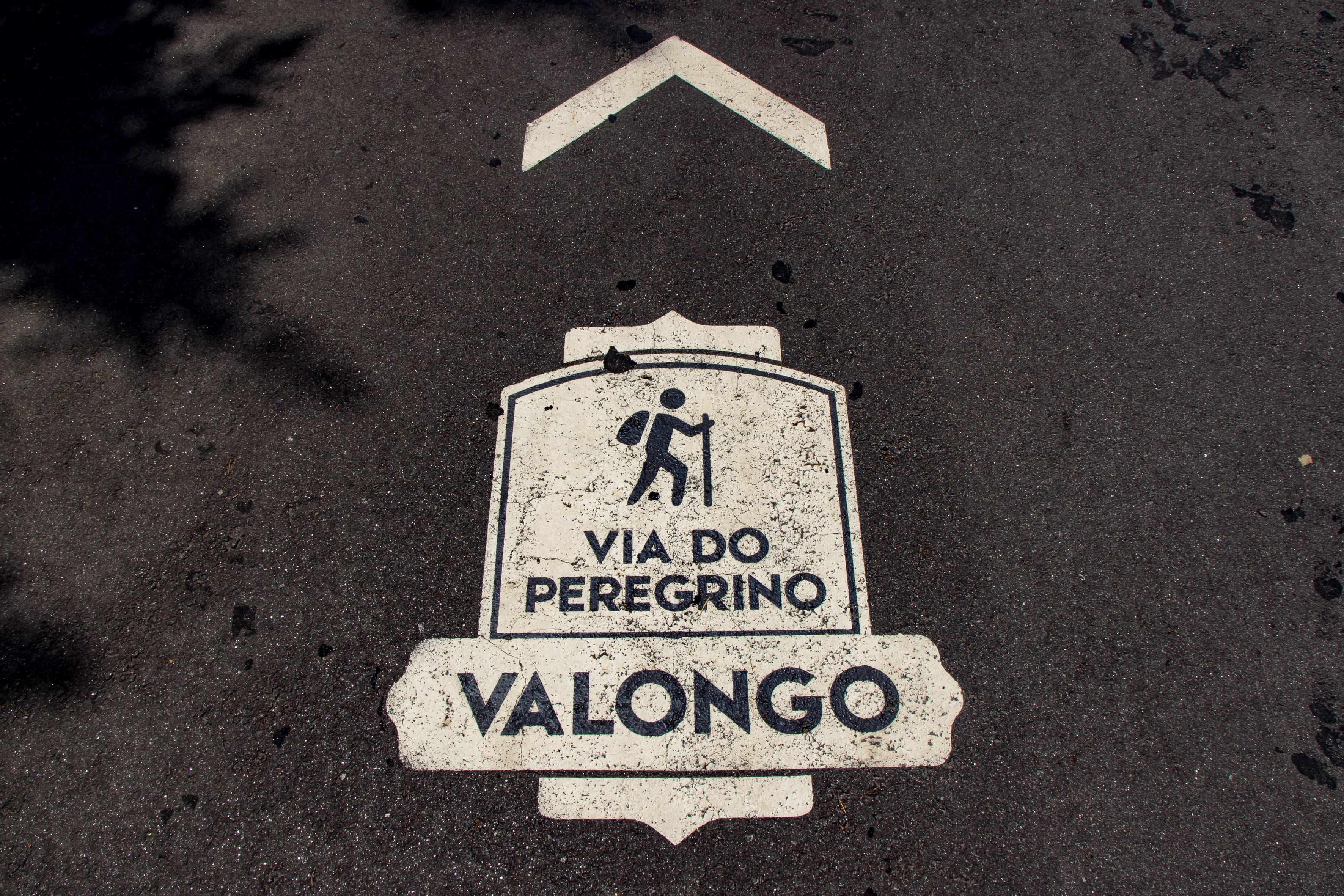
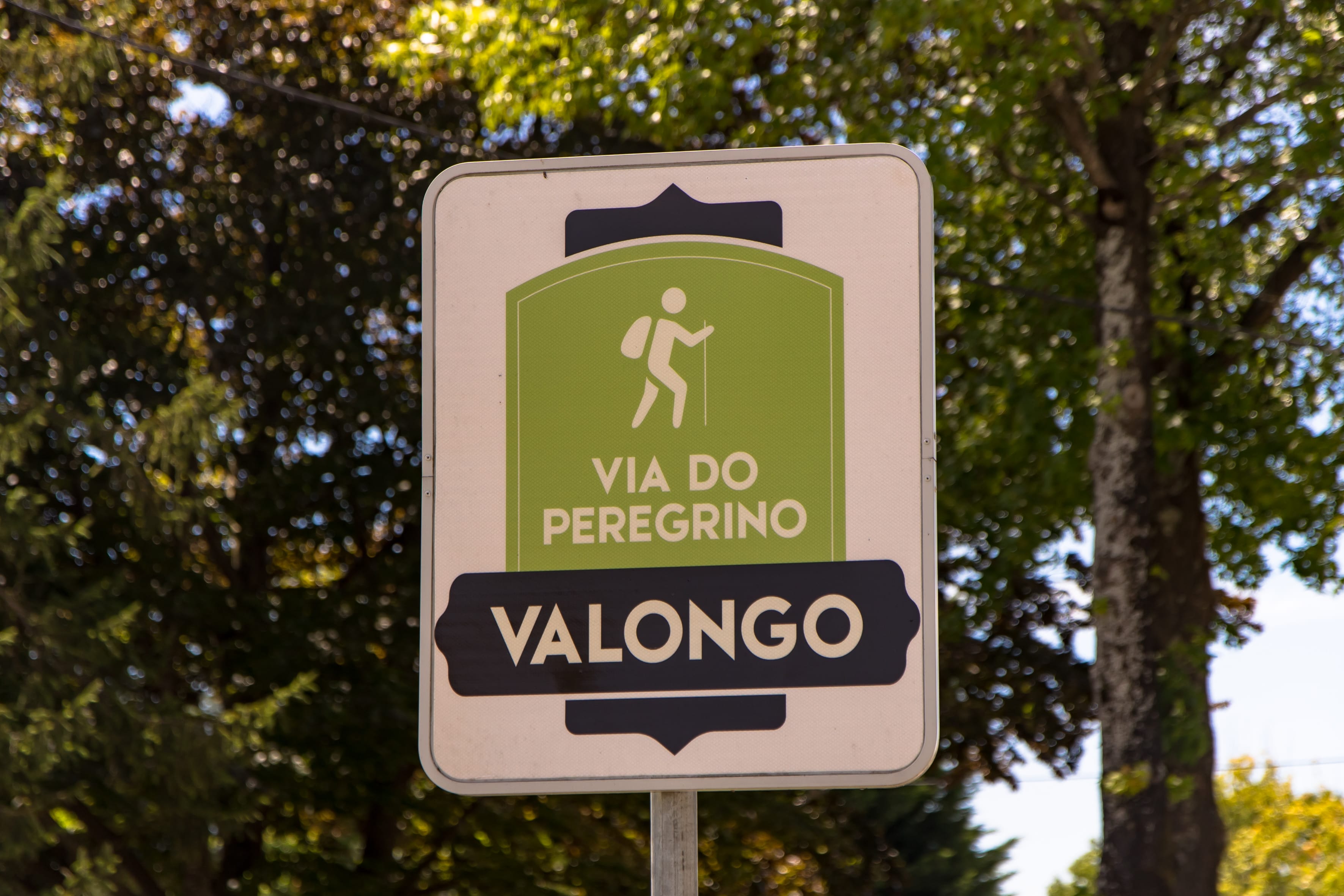
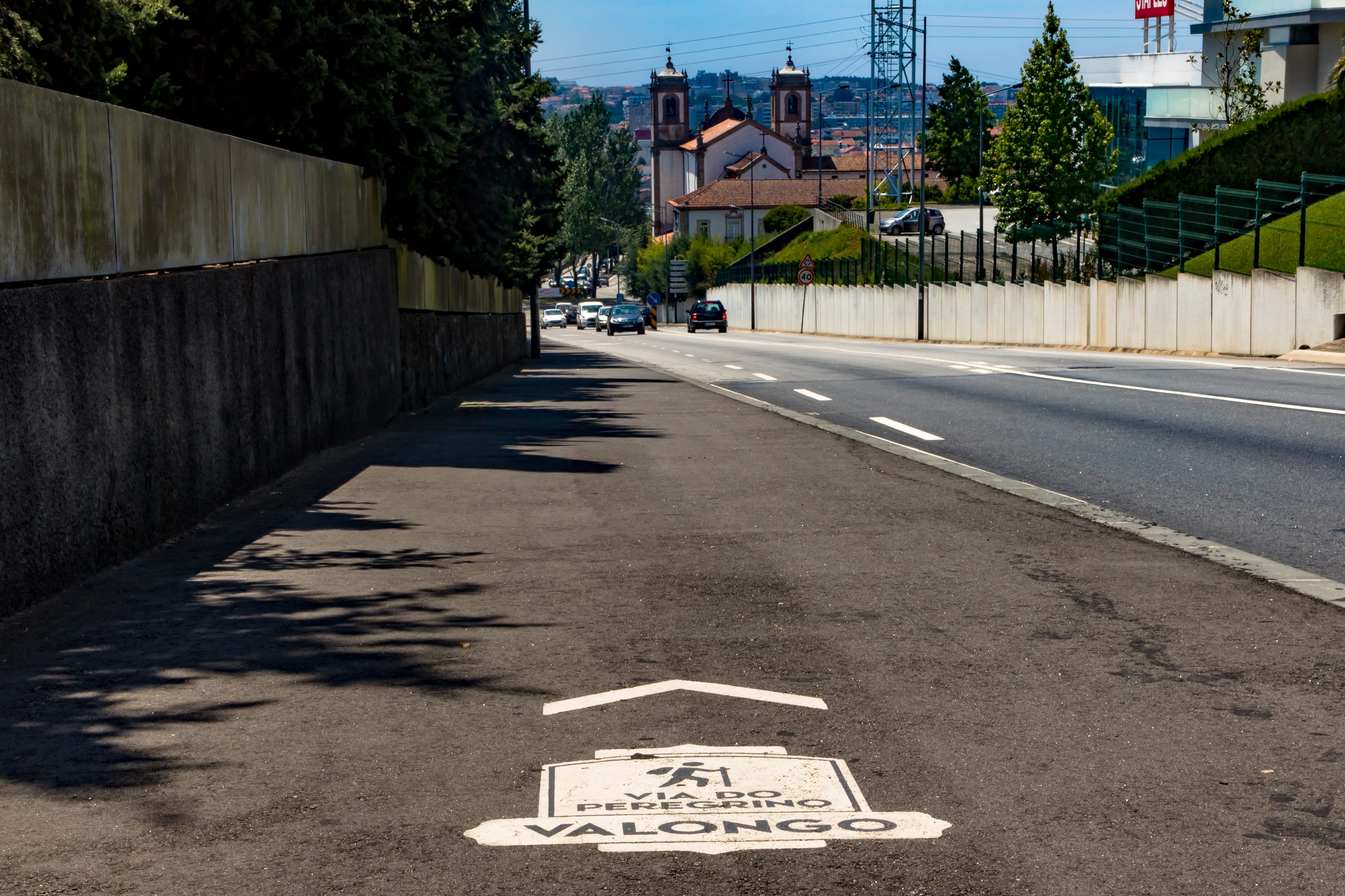
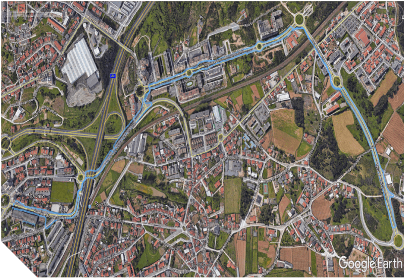
A "Via do Peregrino" é intervenção/obra financiada pelo Programa Norte 2020 com uma extensão de 3.7 quilómetros, ao longo da Estrada Nacional 15, liga o centro de Valongo à Igreja de Santa Rita, em Ermesinde, permitindo a ligação pedonal entre as duas maiores cidades do concelho: Valongo e Ermesinde
Este itinerário, muito utilizado pelos peregrinos que se dirigem ao Santuário, foi requalificado, com a melhoria, construção e definição de passeios com a implementação de balizadores onde não foi possível a sua construção, colocação de sinalética e encaminhamento de águas pluviais, garantindo assim a continuidade dos percursos pedonais para o conforto e segurança dos peões.Este percurso, com as benfeitorias realizadas permite a sua utilização para outras finalidades, por exemplo, para caminhadas e corrida, fomentando a prática desportiva, o bem-estar e a melhoria da saúde da população.
De média dificuldade, face aos declives existentes, pode ser utilizado por pessoas com alguma preparação física e hábitos desportivos.
A 2ª fase desta importante infraestrutura será materializada a breve prazo.
Esta intervenção está incluída no Plano de Mobilidade Urbana Sustentável e no Plano de Ação do Plano Municipal de Acessibilidade para todos. A concretização destas obras, assim como outras de idêntica valência, são de extrema importante para a melhoria do espaço público e para a qualidade da mobilidade urbana pedonal. As medidas a implementar permitirão eliminar barreiras, corrigir debilidades e ir mobilizando a população para a criação de cidades para todos, assim como dinamizadoras e incentivo à prática de atividade física e consequentemente a melhoria da qualidade de vida.
The "Via do Peregrino" is an intervention/work financed by the Norte 2020 Program with a length of 3.7 kilometers, along National Road 15, connects the center of Valongo to the Church of Santa Rita, in Ermesinde, allowing the pedestrian connection between the two largest cities in the municipality: Valongo and Ermesinde
This itinerary, much used by pilgrims heading to the Sanctuary, was reclassified, with the improvement, construction and definition of walks with the implementation of beacons where it was not possible to build them, placing signs and routing of rainwater, thus ensuring the continuity of pedestrian routes for the comfort and safety of pedestrians.
This route, with the improvements made, allows its use for other purposes, for example, for walking and jogging, promoting sports, well-being and improving the health of the population.
Of medium difficulty, given the existing slopes, it can be used by people with some physical preparation and sporting habits.
The 2nd phase of this important infrastructure will materialize in the short term.
This intervention is included in the Sustainable Urban Mobility Plan and in the Action Plan of the Municipal Plan for Accessibility for All. The completion of these works, as well as others of similar importance, are extremely important for the improvement of public space and for the quality of pedestrian urban mobility. The measures to be implemented will make it possible to eliminate barriers, correct weaknesses and mobilize the population to create cities for all, as well as stimulating and encouraging the practice of physical activity and, consequently, improving the quality of life.