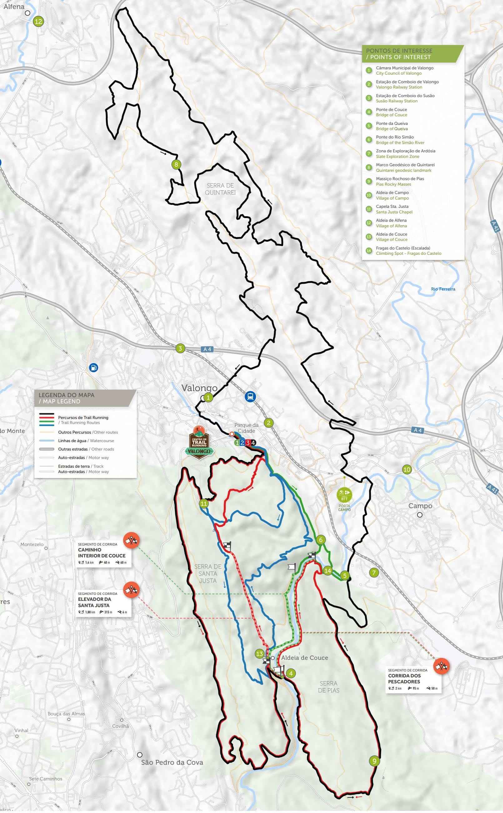
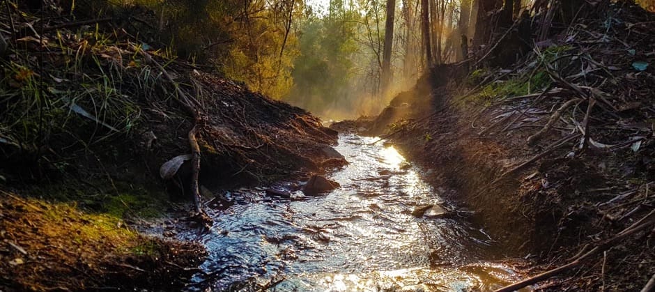
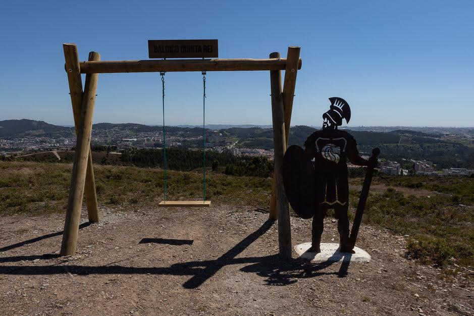
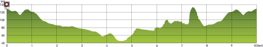
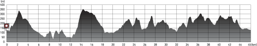
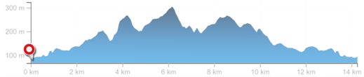
Mapa / Trails

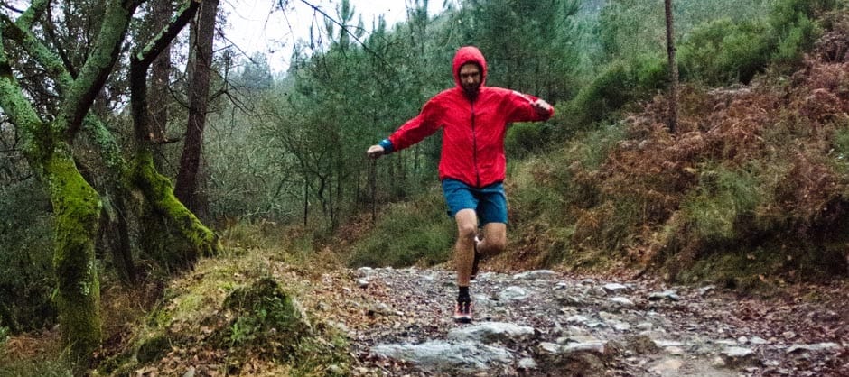
90km de percursos pelas Serras de Santa Justa, Pias e Quintarei - um pulmão da região do Porto que esconde locais únicos para a 
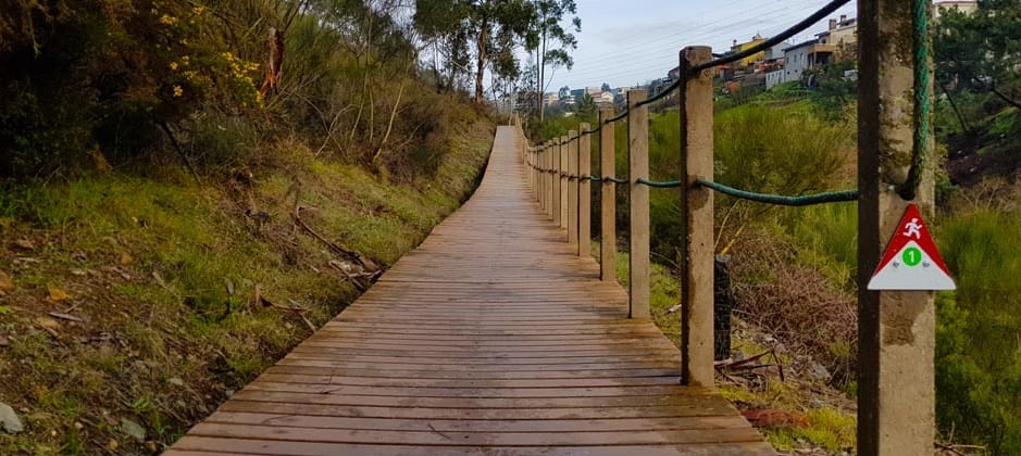
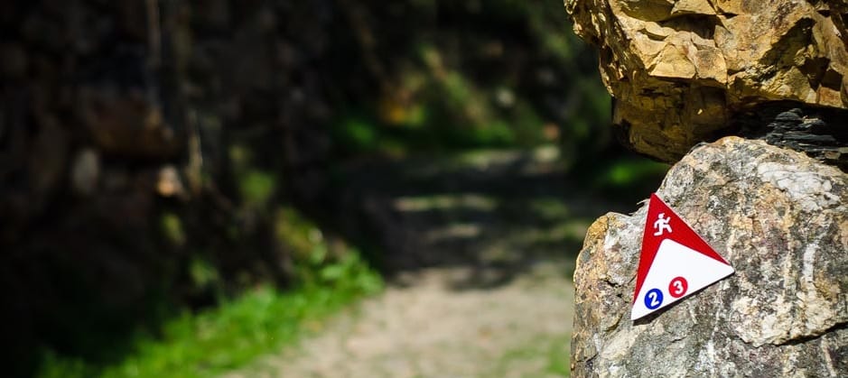
prática de Trail Running, com sinalética refletora, o que permite a prática noturna.
trail map

Centro De Trail Running / Trail Running Center

VALONGO

course image
1
TRILHO DO RIO FERREIRA
TRAIL OF THE FERREIRA RIVER
course image
2
TRILHO DA SANTA JUSTA
TRAIL OF THE SANTA JUSTA MOUNTAIN
course image
3
TRILHO DO PALEOZÓICO
TRAIL OF THE PALEOZOIC
course image
4
TRILHO DO VALE LONGO
TRAIL OF THE LONG VALLEY
Percurso Route
Distancia Distance
Duração Time
desnivel
DESNÍVEL POSITIVO POSITIVE HEIGHT GAIN
altura
ALTITUDE MÁX/MIN MAX/MIN ALTITUDE
altimetria
GRÁFICO DE ALTIMETRIA ELEVATION GRAPHIC
1
TRILHO DO RIO FERREIRA
TRAIL OF THE FERREIRA RIVER
10 km 1 h 30 m 400 m 140/30 m graph_image
2
TRILHO DA SANTA JUSTA
TRAIL OF THE SANTA JUSTA MOUNTAIN
12 km 2 h 650 m 370/70 m graph_image
3
TRILHO DO PALEOZÓICO
TRAIL OF THE PALEOZOIC
23 km 3 h 30 m 1300 m 350/50 m graph_image
4
TRILHO DO VALE LONGO
TRAIL OF THE LONG VALLEY
45 km 6 h 2100 m 350/30 m graph_image
Percursos / ROUTES
1
TRILHO DO RIO FERREIRA
Um percurso acessível a todos na proximidade do Rio Simão e do Rio Ferreira. A sua pequena distância e o seu desnível são propícios à iniciação ao Trail Running por parte de todos. O percurso percorre a margem do Rio Simão até ao lugar da Azenha. Nos moinhos do “Cuco” encontra o Rio Ferreira e percorre a sua margem até chegar a Couce – uma carismática “Aldeia de Portugal”, onde atravessa as suas ruelas entre casas típicas construídas com vestígios de uma intensa mineração romana e carvalhais repletos de biodiversidade. O regresso faz-se pela margem esquerda do rio pelo denominado “Caminho dos Pescadores”, com grande proximidade do rio e no limite do leito de cheia, até às imponentes “Fragas do Castelo”. Pouco depois uma bonita ponte faz o atravessamento do Rio Ferreira para uma subida ao ponto mais alto do percurso. A descida seguinte leva o praticante novamente aos moinhos do “Cuco” com o regresso pelo percurso da vinda.
2
TRILHO DA SANTA JUSTA
Um percurso de iniciação ao Trail Running com alguma dificuldade dada a inclinação de alguns troços. A subida à Capela de Santa Justa e aos pontos mais altos e panorâmicos da Serra permite observar algumas das vistas mais impressionantes de Valongo sobre o Porto e as suas cidades vizinhas. Permite também contemplar o esplendor do Vale de Couce antes de descer até próximo do Rio Ferreira. Uma nova subida pela encosta leva o praticante até a um novo local panorâmico sobre o vale, onde se pode observar o serpentear do Rio Ferreira com a Aldeia de Couce de fundo. Uma descida mais abrupta leva de novo o percurso ao Rio Simão regressando pela sua margem.
3
TRILHO DO PALEOZÓICO
Um percurso de média dificuldade que percorre alguns dos locais mais emblemáticos das Serras de Santa Justa e Pias. Composto por vários “single tracks” e subidas emblemáticas, este percurso é já um desafio assinalável para os praticantes de Trail Running. O seu traçado interseta-se duas vezes com a Ponte de Couce e o Rio Ferreira no local com menor quota altimétrica do percurso. Grande parte do seu traçado encontra-se no Parque Paleozóico – um valor notável pela sua importância geológica. Inclui também dois “segmentos de corrida” onde o praticante pode testar a sua performance. De salientar a subida do “Elevador da Santa Justa” (segmento de corrida) conhecida por muitos pela sua dureza. A subida à cumeada da Serra de Pias é também especial passando por alguns locais de admirável beleza e dificuldade elevada.
4
TRILHO DO VALE LONGO
Um percurso de elevada dificuldade pela distância e onde se percorrem alguns dos trilhos mais emblemáticos do concelho. Percorre 4 freguesias e uma área considerável do Concelho e aproxima a prática de Trail Running entre as Serras de Santa Justa e Pias e as Serras de Quintarei. Pelas suas vistas panorâmicas e pelos locais que atravessa é uma excelente forma de conhecer o vale longo que dá o nome ao Concelho de Valongo. Atravessa uma pequena parte da vila de Campo e da cidade de Valongo em dois momentos distintos, permitindo o apoio ao praticante quer para reforço alimentar, hidratação ou mesmo apoio externo. Tendo em consideração a distância e o desnível acumulado, recomenda-se apenas a pessoas com boa preparação física e que tenham completado distâncias intermédias com facilidade.
1
TRAIL OF THE FERREIRA RIVER
A course accessible to all the people. It follows the “Simão” River and the “Ferreira” River. Its small distance and its low altimetry are prone to the initiation in Trail Running by all. The course runs along the banks of the “Simão” River to the “Azenha” locality. In the “Cuco” (Cuckoo) Mills it finds the “Ferreira” River and runs along its bank until it reaches “Couce” - a charismatic “Aldeia de Portugal” (a Portuguese certification for typical rural villages), where it crosses the alleys between typical houses built with vestiges an intense Roman mining and oak trees full of biodiversity. The return runs by the left bank of the river by the so-called “Caminho dos Pescadores” (path of the Fishermen), with great proximity of the river and in the limit of flood, until the impressive “Fragas do Castelo” (Castle Cliffs). Shortly after, a beautiful bridge crosses the “Ferreira” River to climb to the highest point of the course. The next descent takes the practitioner again to the “Cuco” Mills with the return by the same path of the beginning of the route.
2
TRAIL OF THE SANTA JUSTA MOUNTAIN
An initiation course to Trail Running with some difficulty given the slope of some sections. The climb to the “Santa Justa” Chapel and to the highest and panoramic points of the mountains allows one to observe some of the most impressive views of “Valongo” over Porto and its neighboring towns. It also allows to contemplate the splendor of the “Couce” Valley before descending until near the Ferreira River. A new ascent up the slope takes the practitioner to a new panoramic place over the valley where he can observe the meandering of the “Ferreira” River with the village of “Couce” in the background. A more abrupt descent leads the route back to the “Simão” River returning by its margin.
3
TRAIL OF THE PALEOZOIC
A course of medium difficulty that runs through some of the most emblematic places of the “Santa Justa” and “Pias” Mountains. Composed by several single tracks and emblematic climbs, this course is a relevant challenge for Trail Runners. Its route intersects twice with the “Ponte de Couce” (the bridge at Couce) over the Ferreira River in lowest part of the route. Most of its course is included in the Paleozoic Park – a notable value for its geological importance.. It also includes two “race segments” where the practitioner can test its performance. Worthy of note is the “Santa Justa” Elevator climb (race segment) known by many by its toughness. The ascent to the “Pias” Mountain’s summit is also special by its difficulty and as it goes through some very beautiful places.
4
TRAIL OF THE LONG VALLEY
A course of great difficulty by its distance and where one may cross some of the most emblematic trails of Valongo. It crosses 4 villages of “Valongo” and a considerable area of its territory and brings closer the practice of Trail Running between the “Santa Justa” and “Pias” Mountains and the “Quintarei” Mountains. For its panoramic views and the places that it crosses it is a great way to get to know the long valley that gives the name to Valongo (that phonetically resembles “long valley” in Portuguese and is the reason for its name). It crosses a small part of the village of “Campo” and the city of “Valongo” in two different moments, allowing the practitioner to have some support in food reinforcement, hydration or even external support. Taking into account the distance and the cumulative elevation gain, it is recommended only to people with good physical preparation and with experience in completing intermediate distances with ease.
Normas de conduta / Rules of the trail
  1. Mantenha-se no trilho traçado
  2. Preserve a flora e evite perturbar a fauna
  3. Evite fazer ruído desnecessário
  4. Não deixe lixo ou outros vestígios de passagem
  5. Não faça lume
  6. Não colha amostras de plantas ou rochas
  7. Seja afável com as pessoas que encontre no local
  1. Remain on the pre-determined trail
  2. Preserve the flora and avoid disturbing the fauna
  3. Avoid making unnecessary noise
  4. Do not litter or leave other traces of your passage
  5. Do not make fire
  6. Do not collect samples of rocks or plants
  7. Be friendly with the people you find on the site
Recomendações / Recomendations
  1. Evite correr riscos desnecessários
  2. Realize os percursos de maior dificuldade acompanhado
  3. Evite realizar os percursos durante a noite
  4. Leve sempre consigo água, comida e vestuário em excesso, frontal, apito e manta térmica
  5. Ter sempre consigo um telemóvel com bateria e os contatos de emergência
  6. Avise sempre um familiar ou amigo do percurso que vai realizar e as horas previstas de início e fim da sua atividade
  1. Avoid taking unnecessary risks
  2. Perform the more difficult routes accompanied
  3. Avoid performing routes during the night
  4. Always take water, food and clothing in excess, a headlamp, a whistle and a thermal blanket
  5. Always have on you a phone with battery and the emergency contacts
  6. Always notify a family member or friend of the route that you will perform, and the estimated time for the beginning and end of your activity
Sinalética usada / Signage used
sinaletica
Pontos de Interesse / Points of Interest
1
Câmara Municipal de Valongo
City Council of Valongo
2
Estação de Comboio de Valongo
Valongo Railway Station
3
Estação de Comboio do Susão
Susão Railway Station
4
Ponte de Couce
Bridge of Couce
5
Ponte da Queiva
Bridge of Queiva
6
Ponte do Rio Simão
Bridge of the Simão River
7
Zona de Exploração de Ardósia
Slate Exploration Zone
8
Marco Geodésico de Quintarei
Quintarei geodesic landmark
9
Maciço Rochoso de Pias
Pias Rocky Masses
10
Aldeia de Campo
Village of Campo
11
Capela Sta. Justa
Santa Justa Chapel
12
Aldeia de Alfena
Village of Alfena
13
Aldeia de Couce
Village of Couce
14
Fragas do Castelo (Escalada)
Climbing Spot - Fragas do Castelo
SEGMENTOS DE CORRIDA / RACE SEGMENTS

Os segmentos de corrida são troços de alguns dos percursos existentes em que o atleta pode avaliar a sua performance em três níveis:

  1. Excelente
  2. Bom
  3. Razoável

Para isso bastará iniciar a cronometragem do seu tempo aquando da passagem de uma baliza de início de segmento, seguir o respetivo percurso (seguindo as marcações do mesmo) à máxima velocidade que consiga e parar a contagem mal passe a baliza de chegada do segmento. Nessa baliza encontrará informação que lhe permitirá classificar a sua performance em função do tempo.

The race segments are sections of some of the existing courses in which the athletes can evaluate their performance in three levels:

  1. Excellent
  2. Good
  3. Reasonable

To do this, they just need to start the clock when passing a start segment pole, to follow its route (following its signage) at the maximum speed that they can, and stop the clock as soon as they reach the segment finish pole. In this finish pole information they will find information that will allow them to classify their performance based on the elapsed time.